How to buy the maps
You may order using the address email@duryandrewsmapofhertfordshire.co.uk.
All maps are printed on 180g paper using original Epson pigment-based inks.
Layouts available:
a. Map of the whole county in 2 sizes
- 50 by 36 inches: £45
- 57 by 41 inches (scale of 1.4 inches to the mile): £50
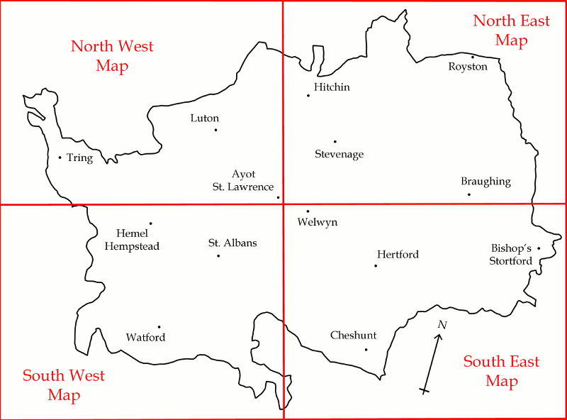
b. The county divided into four equal sheets (see 4 sheet plan)
- North West
- North East
- South West
- South East
Each map is 48 by 36 inches and costs £40 each or £36 each if all four maps are purchased.
c. Custom sheets covering individual parishes or groups of parishes can be arranged. Prices on application.
d. Map Booklet
- The whole county in six folded sheets in an A4 sized folder with explanatory notes. The maps all slightly overlap to ensure that villages are not always ‘on the edge’. Each map is about 25 by 23 inches, giving a scale of 0.75 miles to an inch. £48
All prices plus p. and p. which varies from £4.50 to £8.
ISBN Numbers:
| ISBN-13 | Title |
|---|---|
| 978-0-9574477-0-7 | Dury and Andrews 1766 Map of Hertfordshire Whole county |
| 978-0-9574477-1-4 | Dury and Andrews 1766 Map of Hertfordshire North West sheet |
| 978-0-9574477-2-1 | Dury and Andrews 1766 Map of Hertfordshire South West sheet |
| 978-0-9574477-3-8 | Dury and Andrews 1766 Map of Hertfordshire North East sheet |
| 978-0-9574477-4-5 | Dury and Andrews 1766 Map of Hertfordshire South East sheet |
| 978-0-9574477-5-2 | Dury and Andrews 1766 Map of Hertfordshire Map in six sheets in A4 booklet form |
